Family Genealogy Home Page / Scans of Individual Documents / Contact Information
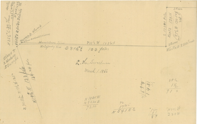
Survey of Hunsickers Line & McCafferty Line
Deer Creek Township,
Pickaway County, Ohio
March 1, 1866
by Lawrence H. Sweetman, Surveyor
Pickaway County, Ohio
Information About This Document
Text of the Document
Click image below for high-resolution version
Document

Information About This Document
The original document was archivally framed so that it would not deteriorate further and then scanned.
If you have additional information or corrections regarding this document, please contact me (see Contact Information at the top of this page).
This information is provided for the use of persons engaged in non-commercial genealogical research
|