The original document was archivally framed so that it would not deteriorate further and then scanned.
If you have additional information or corrections regarding this document, please contact me (see Contact Information at the top of this page).
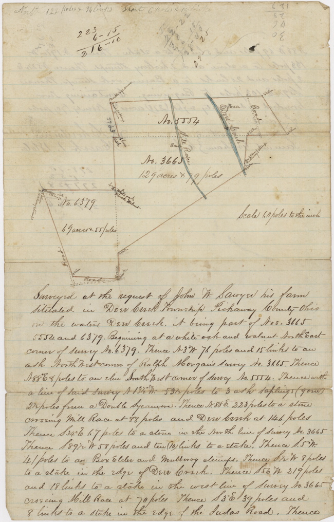
Entire document is hand-written; added notes are {italicized-bracketed}.
CONVERSIONS FOR LAND MEASUREMENTS
Length: 1 chain = 100 links = 4 poles = 4 rods = 66 feet = 20.1168 meters
Area: 1 Acre = 10 square chains = 160 poles = 43,560 square feet = 0.4047 hectare
Front
Scale 60 poles to the inch
Surveyed at the request of John W. Sawyer his farm situated in Deer Creek Township Pickaway County Ohio on the waters of Deer Creek, it being part of Nos. 3665, 5554 and 6379. Beginning at a white-oak and walnut North East corner of Survey 6379. Thence N 3° W 76 poles and 15 links to an ash North West corner of Ralph Morgan's Survey No. 3665. Thence N 88° E 8 poles to an elm South West corner of Survey No. 5554. Thence with a line of said Survey N 13½° W 53½ poles to 3 ash saplings (gone){?} 2½ poles from a Double Sycamore. Thence N. 88 E. 223 poles to a stone crossing mill race at 88 poles and Deer Creek at 146 poles Thence S 34° E 67 poles to a stone in the North line of Survey No. 3665 Thence S 89½ W 58 poles and ten (10) links to a stake. Thence S. 5° W. 41 poles to a Box Elder and Mulberry stumps. Thence S ½ W 8 poles to a stake in the edge of Deer Creek. Thence S 56 W 219 poles and 18 links to a stake in the west line of Survey No. 3665 crossing Mill Race at 70 poles Thence S 3° E 39 poles and 8 links to a stake in the edge of the Judas Road. Thence
Back
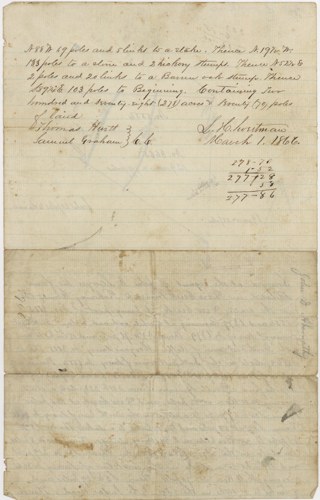
N 88 W 69 poles and 5 links to a stake. Thence N. 19½ W. 133 poles to a stone and 2 hickory stumps. Thence N 52½ E 2 poles and 20 links to a Barren oak stump. Thence S 89¼° E. 103 poles to Beginning. Containing two hundred and seventy-eight (278) acres and seventy (70) poles of land.
Thomas Hurtt, Samuel Graham - C.C.
L. H. Sweetman - March 1, 1866
This information is provided for the use of persons engaged in non-commercial genealogical research
and any commercial use whatsoever is strictly prohibited. Copyright © 2005 by John William Myers III.
|

